
US photo records from 1944 with Utah and Omaha
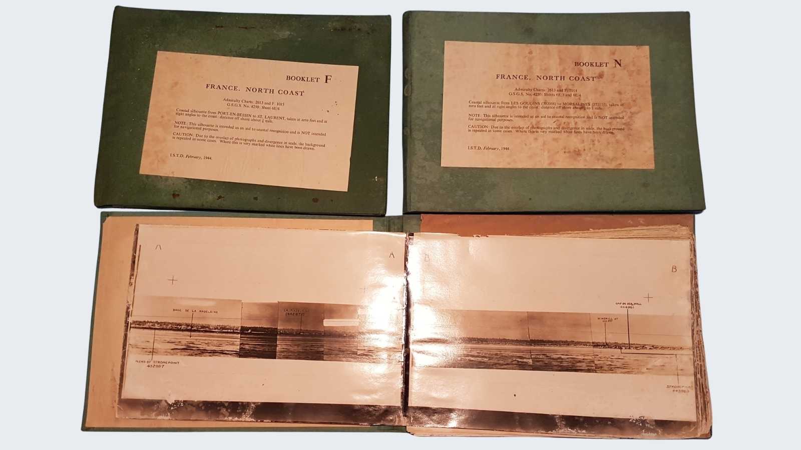
On November 2, 2021, the Normandy Victory Museum has acquired a set of documents of exceptional historical interest: three books of coastal photographs of the Utah and Omaha sectors, originating from Grandcamp-Maisy. Let's discover them together.
Extremely rare documents
These cardboard and green cloth-bound registers were produced by the GSGS, Geographical Section, General Staff. The brochures were prepared by the ISTD (Inter Services Topographical Department) in February 1944, based on photographic surveys carried out on the Normandy coast between the mouth of the Seine and Cap de la Hague.
Note: all the photos taken have been compiled into 16 different books. Normandy Victory Museum owns three of them.
- The Booklet M extends from the Madeleine beach, on Sainte-Marie-du-Mont, to the Hameau du Nord in Gougins.
- Booklet N continues north, as far as Morsalines.
- Booklet F goes from Port-en-Bessin to Saint-Laurent-sur-mer.
These rare documents allow us to discover what the Allies knew about the two key sectors of June 6, 1944: Utah Beach and Omaha Beach. They can be seen at Normandy Victory Museum from Carentan.